The Road to the Top of the World
Touring Canada’s Dempster Highway to the Arctic Ocean

Along Canada’s Klondike Highway is a road sign with an arrow pointing north to the Arctic Ocean. This is kilometer 0 of the Dempster Highway, Canada’s only all-season public road to the Arctic Ocean. This turn to the Arctic is between the cities of Whitehorse in the Yukon and Dawson City in the Northwest Territories, with the ocean some 544 miles away. On this drizzly summer morning, just before reaching the intersection for the Arctic Ocean. we delight in seeing a moose rise above her willow browse.

We traveled a great many miles to get to this point in the adventure and, while reaching the Arctic Ocean is not the final goal of our journey, it is one we’d held loosely as a “maybe” and as a “hopefully” when starting out several months ago. This drive along the Dempster Highway was not always my dream (I didn’t know you could drive to the Arctic until recently), but Jon’s, who loved studying maps as a child and knew it was a possibility. Hours of tracing lines and names on a map of faraway places are brought to life in the Canadian Territories and the Arctic Circle, with a rich culture of indigenous settlers and explorers and adventurers. The spirit is infectious, and the communities are welcoming. It is no wonder that people travel from all over the world to explore this expansive stretch of land.
The Dempster Highway was completed in 1979 and replaced the ice route, where sledges hauled supplies in winter. Ice roads are still used when rivers freeze for the long season. In summer, ferries carry vehicles across wet crossings at the Peel and Mackenzie Rivers. The highway traverses First Nations’ land of Gwich’in and Inuvialuit peoples who long ago settled in this diverse ecosystem built on permafrost. Few and far between, communities are primarily indigenous with subsistence economies combined with natural resource export (oil and gas exploration), and tourism.

Ferry crossing the Peel River

Loaded up and muddy on the Mackenzie River ferry
A wonderful first stop on the Dempster Highway is Tombstone Territorial Park, co-managed by the Yukon government and the Tr’ondek Hwech’in. An agreement ensures that the land and its natural and cultural resources are protected in perpetuity and managed mutually. This approach has become a model for other territories, provinces, and nations, including the U.S., regarding land rights.

Taiga landscape, Goldensides Trail, Tombstone Territorial Park, Yukon
Tombstone Territorial Park is remote with a few hiking trails like “Grizzly Lake” and “Goldensides,” a meandering walk among taiga with lichens in yellow, chartreuse, and jade. The dwarf birch that lines the slopes are deep green now but, come fall, will set the hillside aglow in oranges and reds. Taiga is not quite tundra, not quite boreal forest. It is the transition zone between the two, a subarctic biome of tundra and more southerly plants. The landscape is dramatic among the ragged Tombstone Range, the rushing Klondike River with icy remnants of snow, and the last large cottonwood stands before the change to tundra further north.

Tombstone Territorial Park offers several visitor programs, and we opt for a ranger-led walk along North Klondike Creek. Our small group was made up of a several Americans and Quebecois, and the ranger gave the informal talk in English and in French. The walk was an immersion into cultural land use, including some foraging tips. That evening at camp we were able to pick a few stems of fireweed and bluebells and dandelion to make a Yukon salad and enjoyed it with a cup of Labrador tea.

The subarctic boreal forest is home to both white spruce and black spruce (with needles that smell of lemon and vanilla), aspen, willow, dwarf cranberry, stonecrop, mosses, and wildflowers. On this summer visit, the fireweed is in peak bloom, with roadsides and open meadows in blazing magenta. This synchronous bloom is an Arctic adaptation – bloom quickly, and all at once - to maximize seed production in the short season. The plumes of sedges and clusters of yarrow soften the forest edge.

Back on the road, the highway itself is full of variable conditions with surfaces that change quickly from gravel to mud to dust and back again. Crews work to maintain the highway, but the area has just had days of rain after an unseasonably long winter with record snow fall (and melt). The road is wet and thick in parts. When doing the Dempster Highway, they say to be ready for misadventure – bring extra gas, carry spare tires, be prepared for windshield cracks, watch for wildlife. When meeting a transport truck on the road, one automatically squints and scrunches in anticipation of a flying rock. Kindly, most trucks slow when passing another vehicle, and the windshield remained unscathed.

We had only good adventures, turtling along the highway with a small group of international travelers. Some shipped their expedition vehicles and motorcycles from abroad to do the trek. Leapfrogging each other from camp to camp and marker to marker, the road report becomes the daily news. To the southbound traveler: “Have you been all the way to Tuk? How was the road?” Tuk is the local nickname for Tuktoyaktuk, the northernmost Canadian community on the Arctic Ocean.
The road to Tuktoyaktuk, while in planning since the 1960’s, was only completed in 2017 and closed for a time during the pandemic. Most who travel beyond Tombstone Territorial Park are headed to Tuk, and it can be a comfort to meet those who are making the return trip south, as though a feat has been accomplished (even if that feat is just driving on a long dirt road). A real feat would be to bicycle the road, as some do, with repair kits in tow. Or to go by touring motorcycle, as a group we follow does, complete with travelling support vehicle and travelling support standard poodle (whose name is not Charley, unfortunately).

Pingos, permafrost land formations with ice cores.
Up the road, we spot another moose, this time a male with impressive paddles. Thoreau describes the boreal forest as “mossy and moosey.” We also had a grizzly bear visit camp on this evening; a beautiful blonde bear who poked around but found nothing of interest and moved along on his or her evening rounds. The sun does not set this time of year, and a bright night makes for fine viewing opportunities (and for difficulty sleeping).
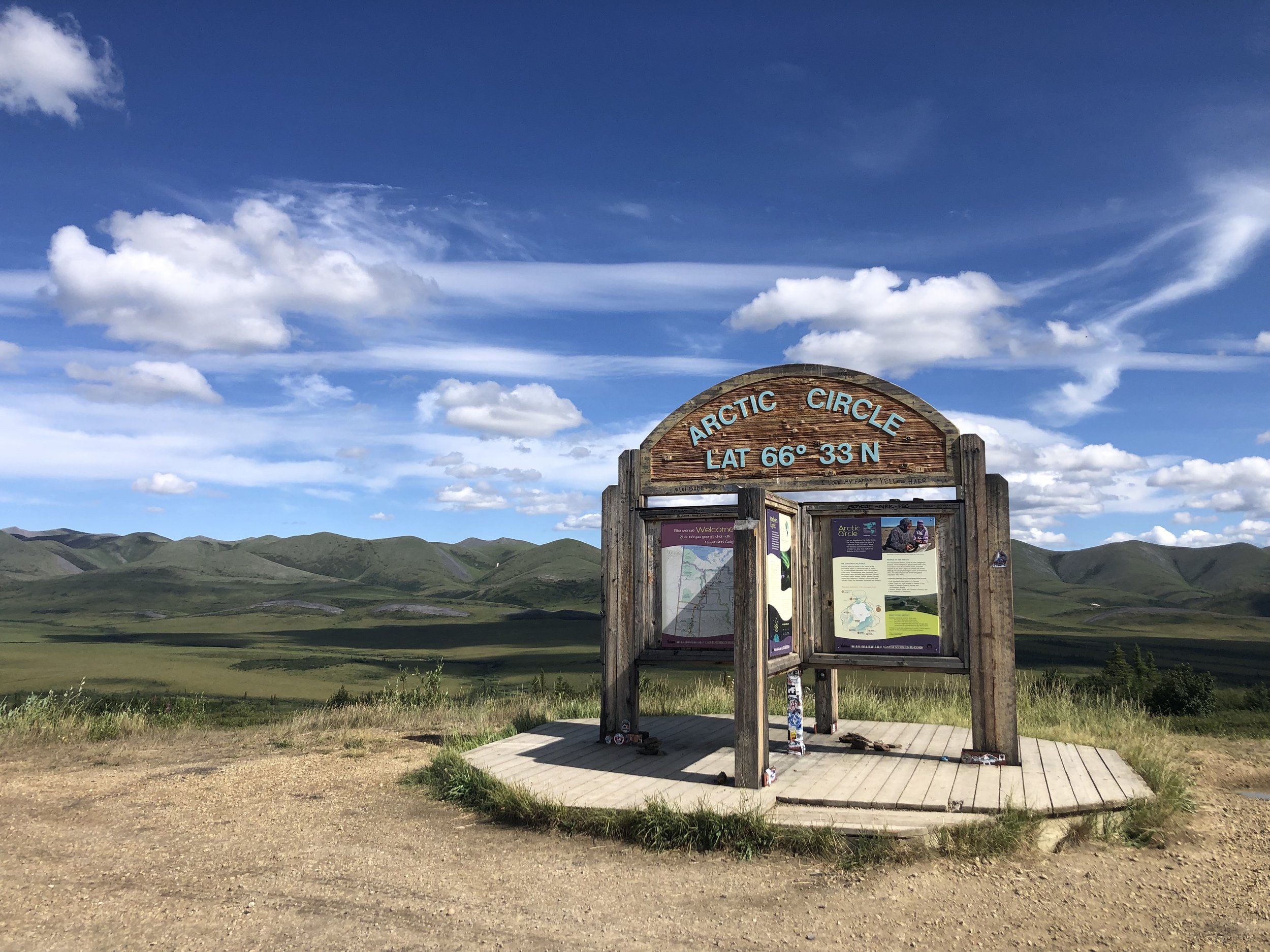
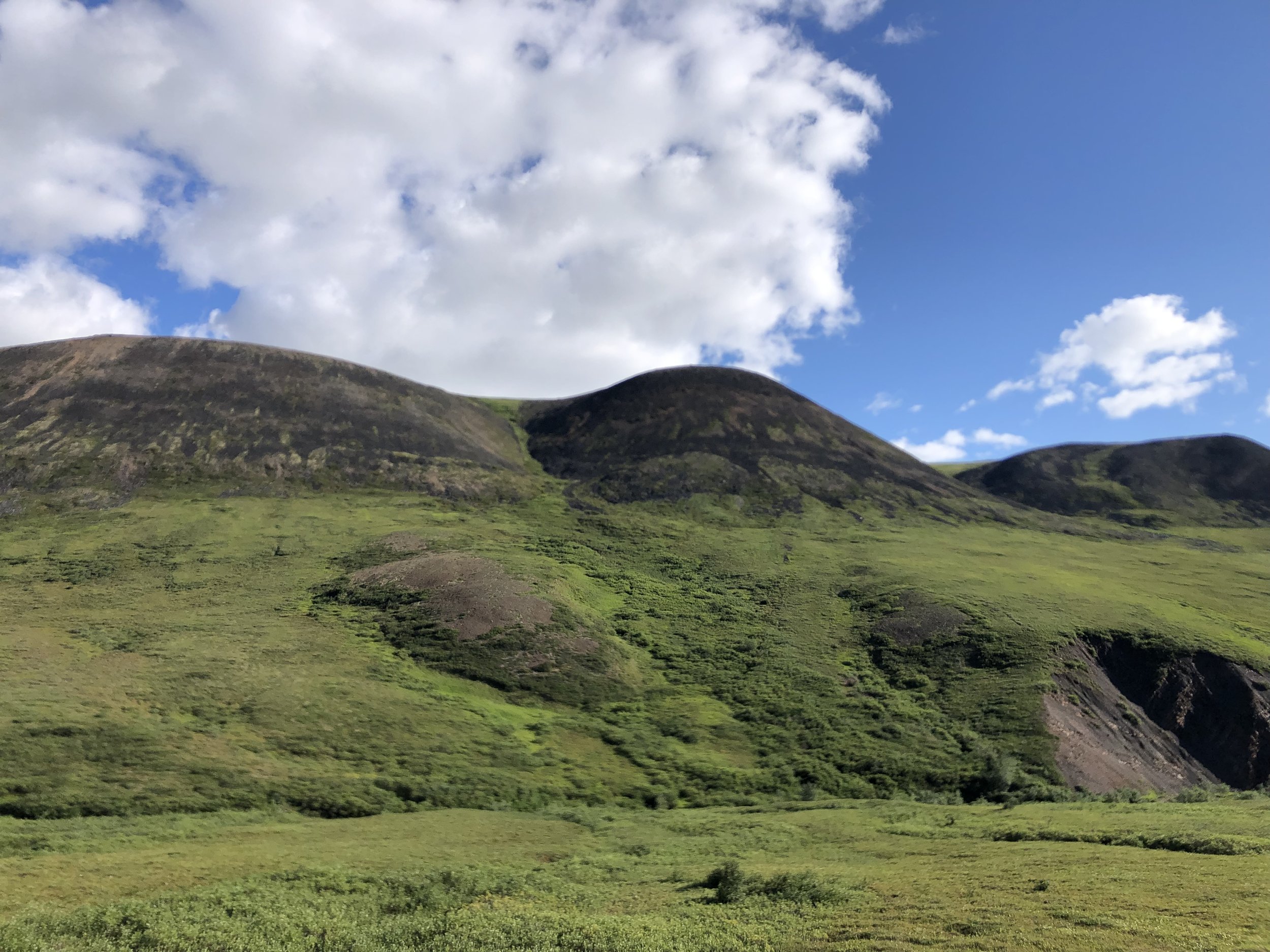
Onward north the traveler crosses the Arctic Circle and begins the ride through the tundra. The tundra in summer is unexpectedly verdant, gleaming. Rolling mountains are carpeted a lush green, very pastoral and inviting. It’s like being placed on a little globe, with papier-mache mountains painted green and the sky a bright blue to match the rivers. With clouds tufts of cotton. The landscape is stunning. The tundra is a surprise.
Crossing the Continental Divide and entering the Northwest Territories, rivers westward flow to the Pacific Ocean and eastward to the Beaufort Sea in the Arctic Ocean. It is surreal to be in the Arctic Circle, with a view of the Mackenzie River delta below. The road descends to meet the delta, linking the communities of Peel River and Fort McPherson to the Dempster Highway’s destination in Inuvik. Inuvik is the northernmost headquarters for commerce and communication and has a population of about 3,400 people. The Inuvik-Tuktoyaktuk Highway is the 80-mile extension that goes all the way to the Arctic Ocean.

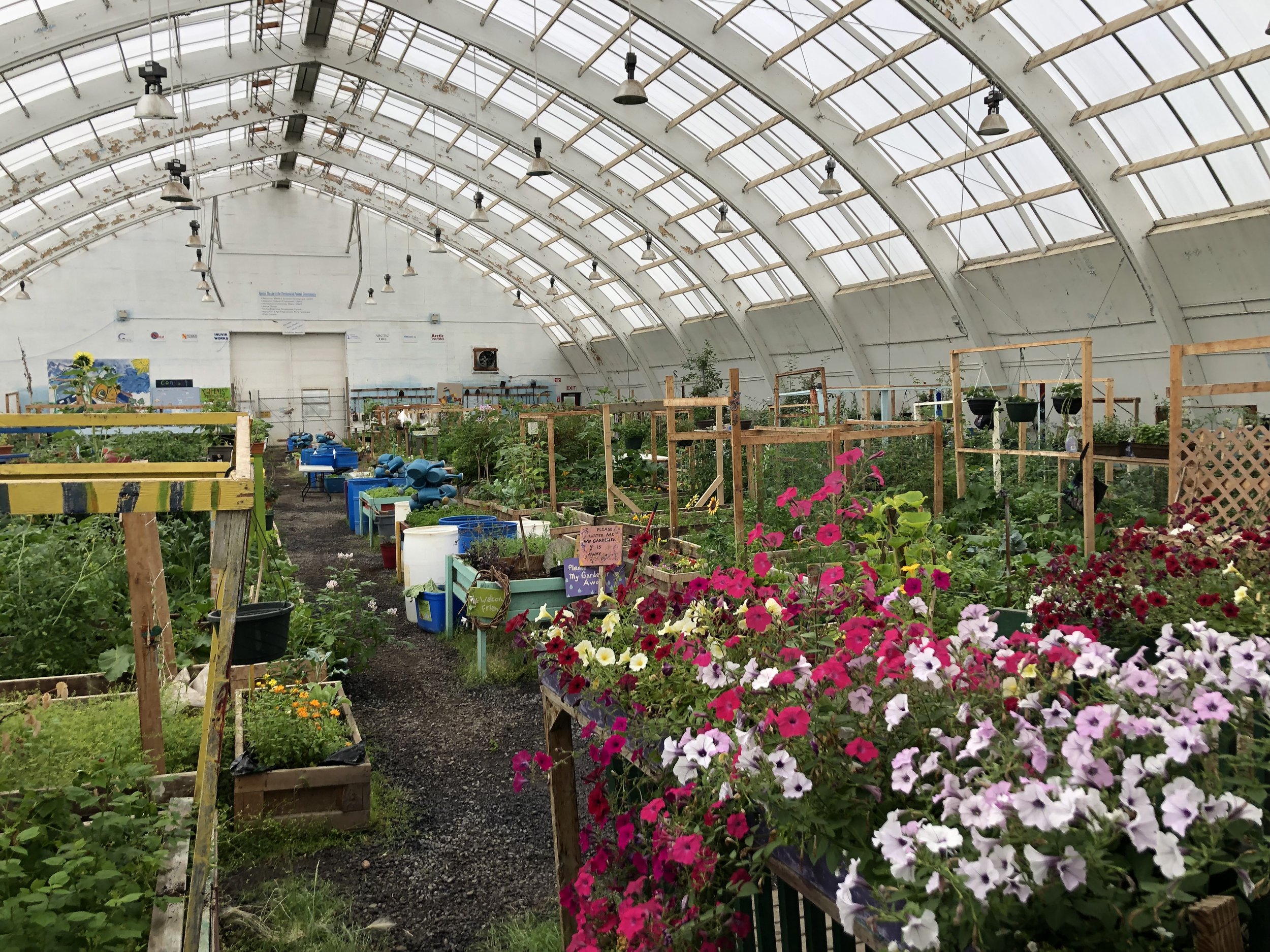
Inuvik has all visitor services, including a cultural center and – a real pleasure - the Arctic’s largest community greenhouse. The covered garden features plots for individuals, plots for the farmer’s market, and plots for the food bank. It ensures area residents have access to fresh food, and the culture of care the garden conveys is impactful.
We made it to the Arctic Ocean. Tuktoyaktuk is a small, indigenous community whose livelihood remains largely based on subsistence hunting, fishing, and trapping, on oil and gas exploits, and, modestly, on tourism. The highway physically ends at the tide line of the Arctic Ocean. Here, you can gaze at the vast ocean and nearby archipelago, wade in the chilly water, and just feel small in the best way. That the journey culminates in this hamlet, specifically in a local fishing area, is such a fitting way to punctuate what has been an immersion into nature and culture throughout the whole of the experience.

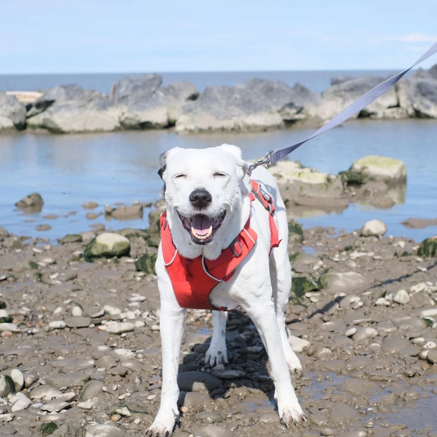
Pearl with Arctic paws

Thank you for reading! Happy adventuring.